The Salt Flats of Uyuni seem to get the headlines all the time when you talk about Bolivia and there is a very good reason for that. They are stunning but they are far from the only natural wonder you can find in Bolivia. Today I would like to highlight some equally stunning natural formations that will blow your mind in both their uniqueness and beauty.
The Reserva Eduardo Avaroa is 714,745 hectares (1,766,170 acres) of protected land in southwestern Bolivia that borders the Salt Flats. If you take a tour of the area that generally includes the Salt Flats its highly likely you will also visit some or all of these destinations too.
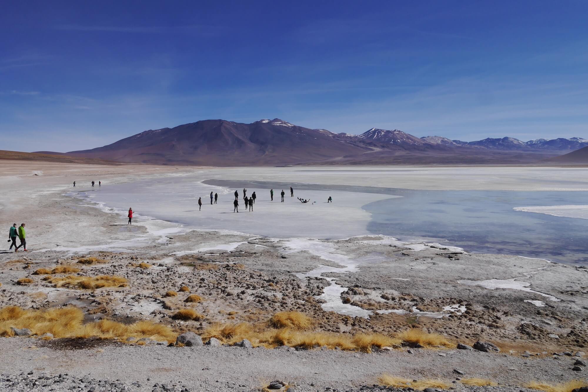
It may look warm but this high up the atmosphere is freezing. The lakes only remain fluid because of their mineral contents.
With very few roadsigns in the national park, you will need an expert in the area to get you from A to B.
The reserve sits in the high Bolivian Altiplano, between 4,200m (13,800ft) and 5,400m (17,700ft) above sea level. Its is far from accessible and if you would like to see some of the sights I talk about today you will definitely need a local guide and a 4X4 vehicle because roads are as scarce in the reserve as road signs. It is here to protect the many species of birds that visit the area not for our comfort. Although the “Bolivian Backrub” (much like the Chilean Backrub except with more dust) provided by some of the tracks is strangely relaxing in a way after the first couple of hours.
I will talk about them in a chronological order travelling from the Chilean Border to the Salt Flats so, no matter which direction you travel, you will know what comes where.
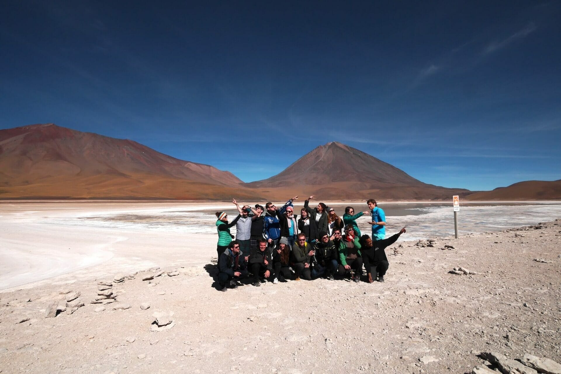
Volcan Licancabur
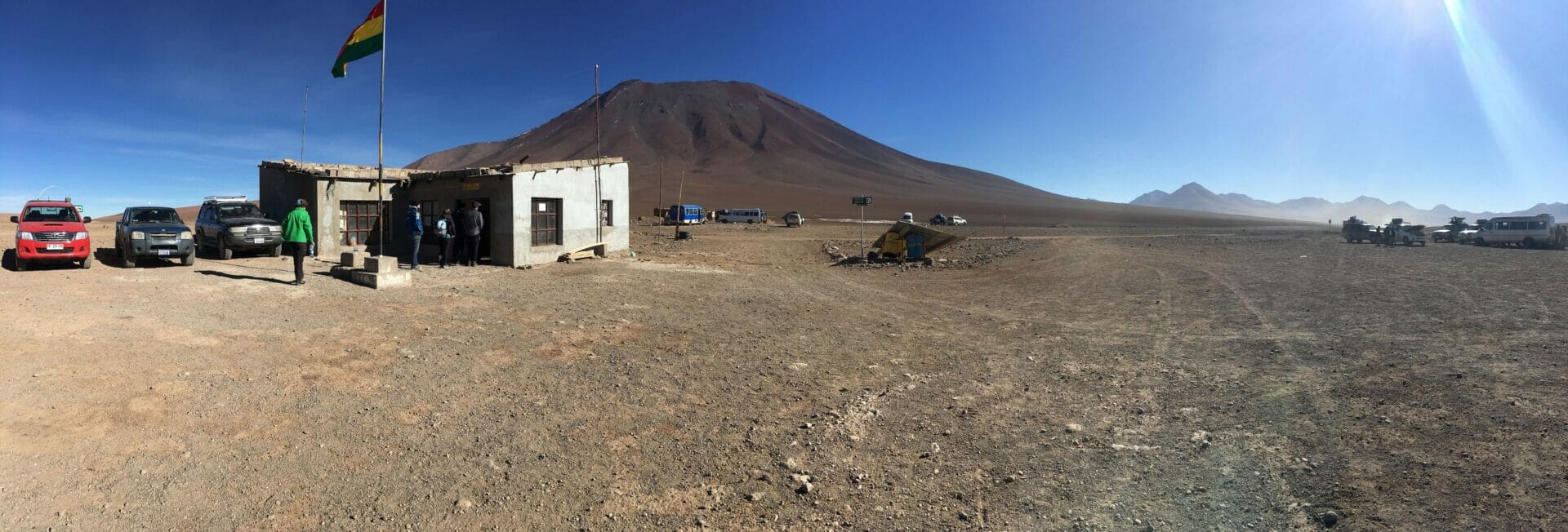
This somewhat temporary looking hut is the border between Chile and Bolivia from the Atacama Desert.
Lets start at the border. The 5,868m (19,252ft) Volcan Licancabur marks the border between the Atacama Desert in Chile and Bolivia. There are no fences as you approach the hut proudly displaying the national flag of Bolivia. There is little to see at the border but, if coming from the Atacama, you will notice a sudden drop in temperature as you exit your vehicle and swap into one much more suited for the “road” conditions. If you have enough time in the area you can take a multi day ascent of the Volcano to admire the views. At it’s heart, in the caldera, is the worlds highest lake which, thanks to the almost permanent subzero temperatures at this altitude, remains frozen for most of the year.
Laguna Blanca (White lake)
The bright blue skies and blazing sunshine disguise the cold atmosphere that is up at this height.
Separated from the smaller Laguna Verde by a small and shallow tributary is the 10km² Laguna Blanca. The high mineral composition of the water gives it it’s milky appearance. Parking up on a ridge, you will have the chance to get out and explore the area a little but you may need to take a top with you. Even in the summer at this altitude the air is very fresh. Depending on the time of year you may even see some flamingoes in the freezing cold waters of this shallow lake.
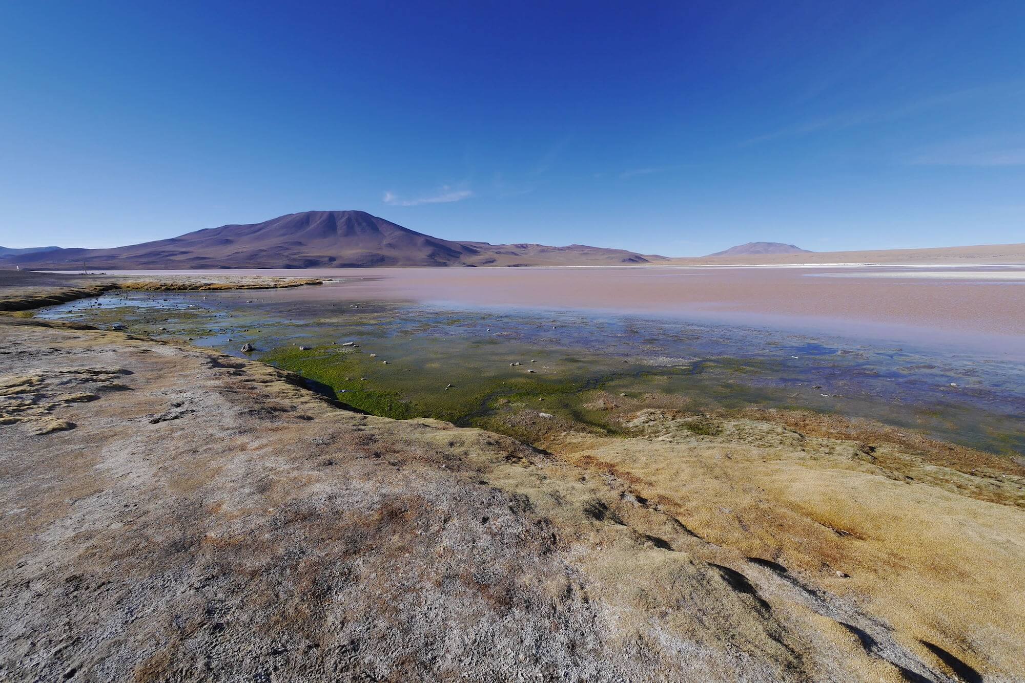
Laguna Verde (Green Lake)

Looking down on the smaller Laguna Verde as a light plane makes a pass.

Crossing between Laguna Blanca and Verde.
Sitting at the base of the still active Juriques Volcano around 30-45 minutes from the border is the Laguna Verde, a salt lake varying in colour from a milky turquoise to a dark emerald green thanks to the levels of arsenic that is suspended in the water. The arsenic allows the water to go below -50C without freezing in the harsh winter months.
Valle de Dali
The unusual landscape in the small Dali Desert is named after the painter because it so resembles many of his paintings.
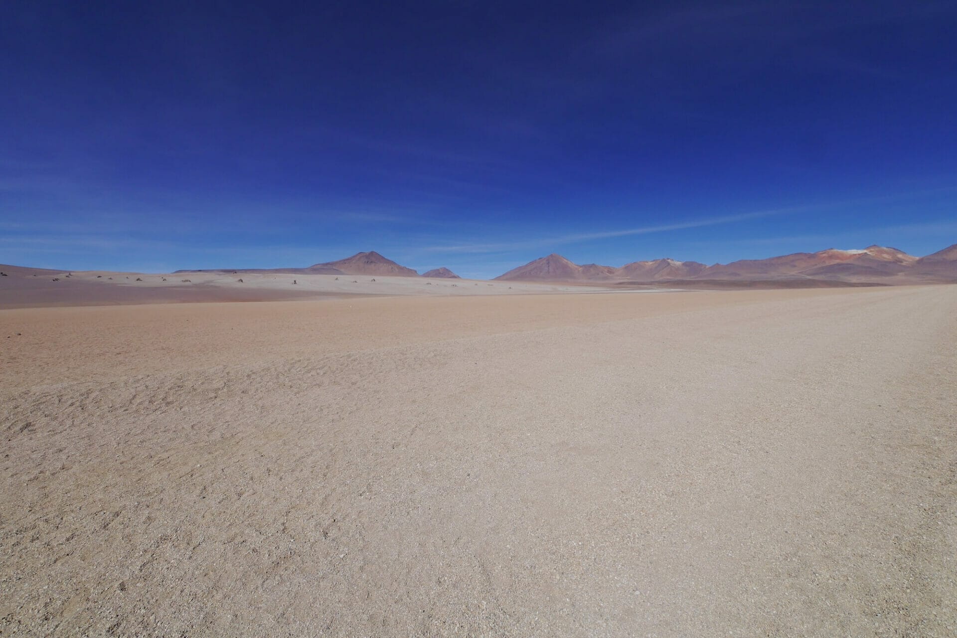
On the way through to the next main stop you will pass through one of the driest places on earth, the high altitude Salvador Dali Desert (or Dali Valley, Valle de Dalí). Although this barren place is named after the famous artist because it resembles some of his abstract paintings, he never actually visited it in his lifetime.
Sol de la Mañana Geysers
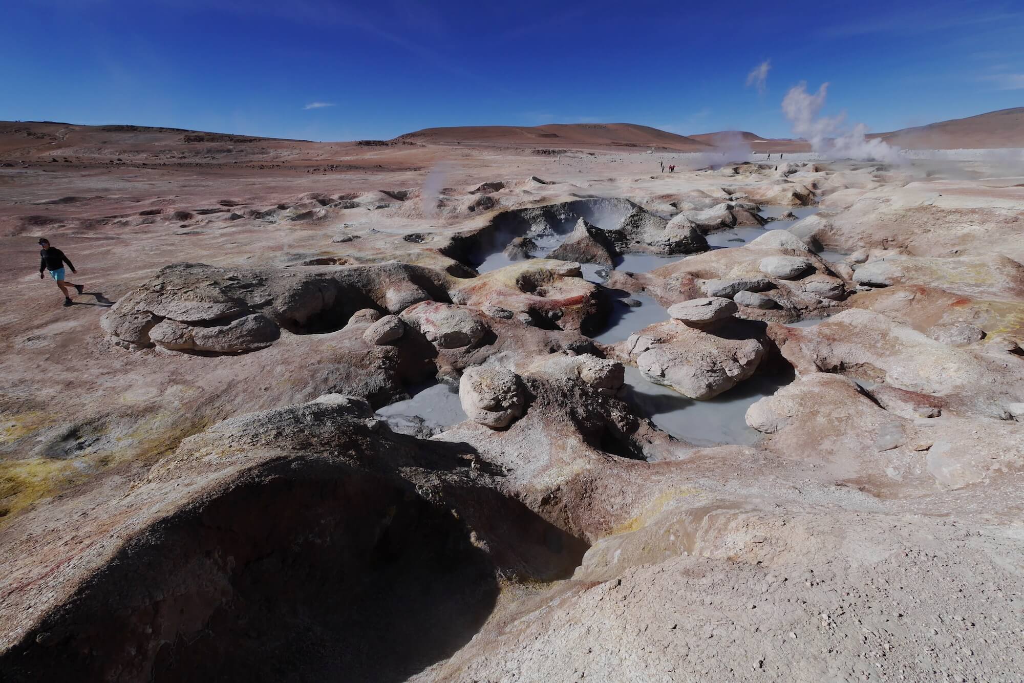
The highest geothermal field on the planet is breathtaking to walk round. I doubt you will be able to get as close to any other than you do these.
It’s hard to imagine them at this height but Sol de Mañana is the highest geyser field on earth. The seismic activity is so great under foot that, even at 5,000m above sea level, you will find the stomach churning rotten egg smell of sulphur hanging in the air like the thick acrid smoke above the bubbling mud pools and very active steam vents. The most activity happens here in the early morning when the air temperature (-20°C in winter and freezing in summer) is at odds with with boiling mud pools and fumaroles which can shoot steam up to 50 meters into the cold climate of the Altiplano to make this small area a beguiling sight.
I wish I could blame my 2 day headache on the sulphur but, all too eager to get every photo opportunity I could, an unwise decision to jog back across the geyser field to the waiting crowd resulted in a painful reminder of the altitude we were currently at. The altitude at this point is so high it’s unwise to hang around longer than 20 minutes or so. Thankfully they have been left in their natural condition and you won’t find a safety barrier within 100km.
Since my visit the mud pools have claimed their first tragic victim, Rod Keates, a 71 year old retiree who got too close to the edge trying to get a picture and fell chest deep into the boiling 250°C mud pool. His catastrophic burns and the absolute remoteness of Sol de la Mañana meant he died before he could receive emergency treatment. The only hint at the danger they can pose is on a faded board but I would hope that common sense would prevail and if you want to explore closer don’t forget to exercise the extreme caution they they deserve.
Laguna Colorada
The Red Lagoon high up in the Bolivian Altiplano. A favourite spot for the rare James’s Flamingoes.
The largest lake in the reserve, covering 23 square miles (60 km2), the Laguna Colorada (Red Lake) is home to the rare James’s Flamingoes which you will likely see walking across the vast red expanse in their thousands in the summer months. Like the other lakes in the area it isn’t very deep, less than a meter in fact. The deep red colour comes from the algae that the flamingoes thrive on.
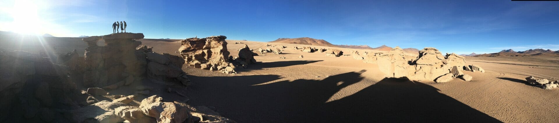
The Sand Dunes Of Siloli

The world famous Stone Tree in the Siloli Desert.
Finally, nearest the shore of the giant Salt Flats and 18 kilometres north of Laguna Colorado, but still at an altitude of 4,800m, you come across one of the most photographed natural formations in Bolivia. Standing like an island of rock in the Desierto de Siloli you will come across the 7 meter high Stone Tree, Arbol de Piedra. Worn down by the constant wind that whips up the surrounding desert to sandblast the soft sandstone leaving this oddly shaped rock tree. Please though, respect the delicate nature and balance of the area. Like the signs say, leave the Arbol de Piedra alone. Climbing the further rock formations still give a wonderful view of the surrounding area.
It’s too cold to stay on the rocks for long but the time you do have in this barren landscape is unforgettable.
The reserve of Eduardo Avaroa is protected for a reason. The many mammals and birds that live here or migrate through the area rely on the precious habitats that lie protected within. Formed out of fire, ice and wind, a delicate balance of nature keeps these areas alive and as a migratory species, tourists that visit the area for 1 or more days should take only photos and leave only footprints. That way we can ensure this wonderful yet delicate ecosystem will be here to support everyone wanting to visit for many more years to come.
 Copyright secured by Digiprove © 2017


